![]()
This site dedicated for geoinformation exchange. Take a look at Geoinfos in this web.
Geoinfos is spatial or non spatial information about geological or environmental resources, especially derived from satellite images or GIS data analysis.
We publish abstracts, maps, and images. Every three months we'll remove the
oldest items. The most recent changes are listed first, and each item is linked to the page with the updated
content. We'll put a notice New! at
the right side of the list.
The following is a recent additions to this web.
 |
 |
 |
 |
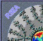
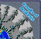
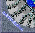
Enhancing Directional Images and Extraction the Lineaments from Band-4 of Thematic Mapper.
Click on the above quadrant parts of Terrasia Image.
![]()
![]()
![]()
![]()
![]()
Power by NedStat |
Copyright Terrasia. For problems or questions regarding this web contact: This page has been visited Last updated: July 06, 2000 |